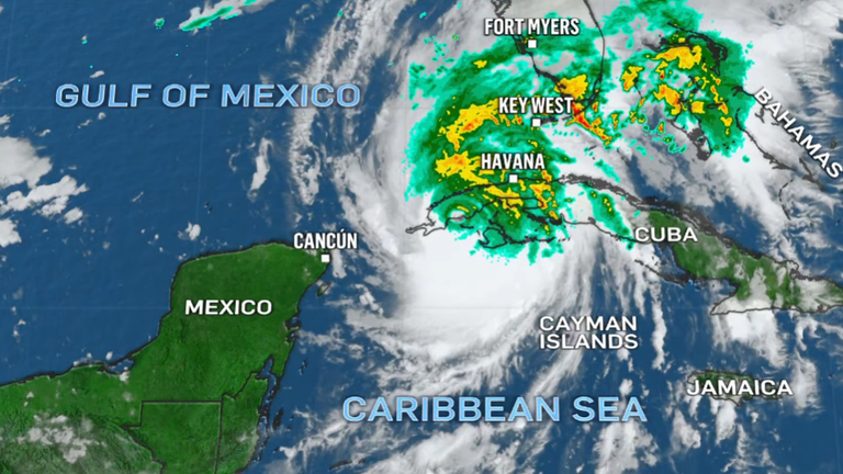
Hurricane Ian is swirling towards Florida after making landfall in Cuba as a powerful Category 3 storm, and could hit the US state with wind speeds of up to 140 mph (225 kmph).
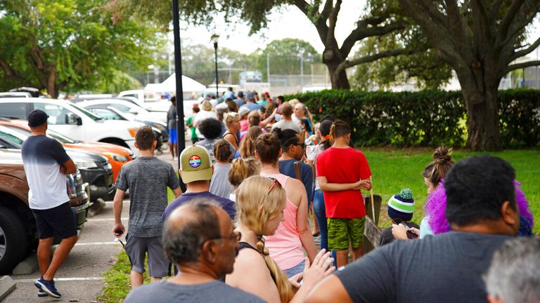
Evacuation orders have been issued for over 300,000 people in Tampa Bay along Florida's west coast, amid fears the hurricane could be upgraded to a Category 4 system as it intensifies while crossing the Gulf's warm waters.
The storm made landfall early on Tuesday in Cuba's Pinar del Rio province, while the US National Hurricane Center said the island's west coast could see as much as 14ft of storm surge.
"Cuba is expecting extreme hurricane-force winds, also life-threatening storm surge and heavy rainfall," hurricane centre senior specialist Daniel Brown told the Associated Press.
Officials set up 55 shelters, rushed in emergency personnel and took steps to protect crops in Cuba's main tobacco-growing region.
After passing over Cuba, Ian is forecast to reach Florida as early as Wednesday as a Category 4 storm.
Governor Ron DeSantis has declared a state of emergency throughout Florida and urged residents to prepare.
He warned of "broad impacts throughout the state" and said the weather system brought with it a risk of a "dangerous storm surge, heavy rainfall, flash flooding, strong winds, hazardous sea, and isolated tornadic activity".
US President Joe Biden declared an emergency, authorising the Department of Homeland Security and the Federal Emergency Management Agency (Fema) to co-ordinate disaster relief and provide assistance to protect lives and property.
Mr Biden also postponed a scheduled 27 September trip to Florida because of the storm.
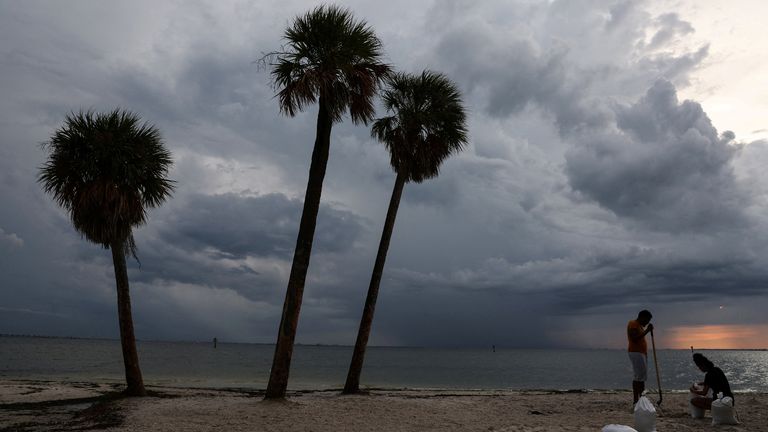
Flooding is predicted for much of the Florida peninsula midweek, and then heavy rainfall is possible for the southeast of the US later this week.
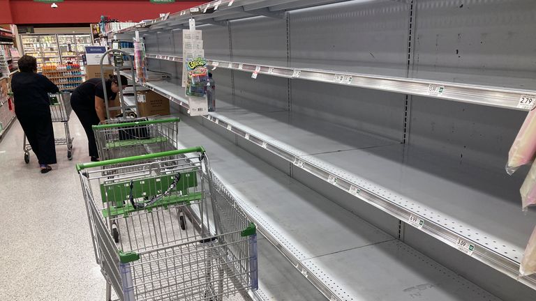
In some parts of Florida, supermarket shelves have been emptied and many residents have placed sandbags around their homes.
"Clearly, when you look at the Tampa Bay area, one of the reasons why we fear storms is because of the sensitivity of this area and the fragility of this area," DeSantis said.
The last time Tampa Bay was hit by a major storm was 25 October, 1921.
Read More:
Storm Ian strengthens into hurricane
Florida emergency declared with Ian set to strengthen
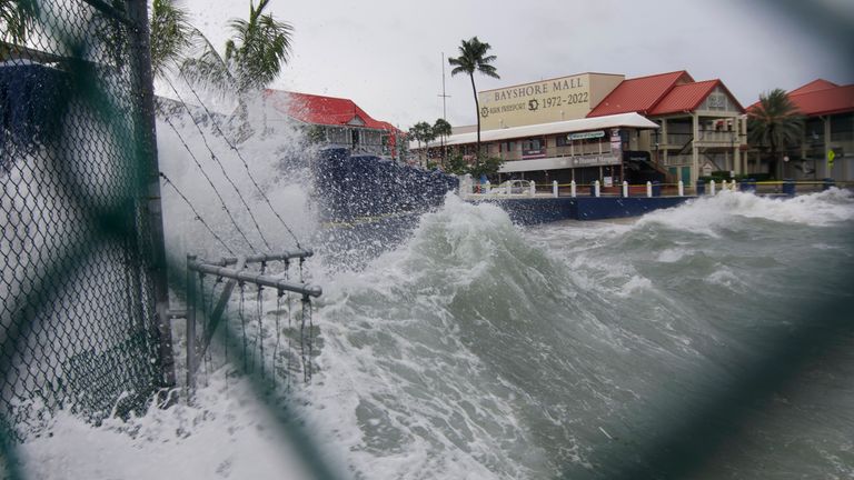
The National Hurricane Center is predicting storm surge in Tampa Bay and surrounding waters of between 5 and 10 feet (1.5 and 3m) above normal tide conditions because of Hurricane Ian.
"That's a lot of rain. That's not going to drain out quickly," Cathie Perkins, emergency management director in Pinellas County, where St. Petersburg and Clearwater are located, told AP. "This is no joke. This is life-threatening storm surge."
The extreme weather event sparked NASA to shelter its Artemis 1 lunar rocket.
While BP and Chevron have shut down their offshore oil platforms in the Gulf of Mexico due to the expected hurricane.
Dr Melissa Lazenby, lecturer in Physical Geography at the University of Sussex, told Sky News the increase in stronger hurricanes is due to climate change.
She said: "The latest IPCC report (AR6) has stated that tropical cyclone (typhoon, hurricane) activity has increased in the higher categories categories 3-5 - i.e. there are more storms with higher rainfall and more extreme winds due to global warming.
"The overall number of tropical cyclones, however, have not increased and potentially have decreased, but the intensity of these storms is clearly escalating to more extreme levels. Typhoon Noru and Storm Ian are clear examples of the increase in more intense tropical cyclone activity".
https://news.google.com/__i/rss/rd/articles/CBMiamh0dHBzOi8vbmV3cy5za3kuY29tL3N0b3J5L2h1cnJpY2FuZS1pYW4taHVydGxpbmctdG93YXJkcy1mbG9yaWRhLWFzLWV4cGVydHMtd2Fybi10aGlzLWlzLW5vLWpva2UtMTI3MDYxODDSAW5odHRwczovL25ld3Muc2t5LmNvbS9zdG9yeS9hbXAvaHVycmljYW5lLWlhbi1odXJ0bGluZy10b3dhcmRzLWZsb3JpZGEtYXMtZXhwZXJ0cy13YXJuLXRoaXMtaXMtbm8tam9rZS0xMjcwNjE4MA?oc=5
2022-09-27 10:53:28Z
1579688235
Tidak ada komentar:
Posting Komentar