Tens of thousands of people are fleeing for safety from the US state of Louisiana as Hurricane Ida closes in.
Ida is expected on make landfall on the Gulf of Mexico on Sunday evening, bringing 140mph (220km/h) winds and a "life-threatening" storm surge.
Forecasters say it could be even stronger than Hurricane Katrina that devastated much of New Orleans in 2005.
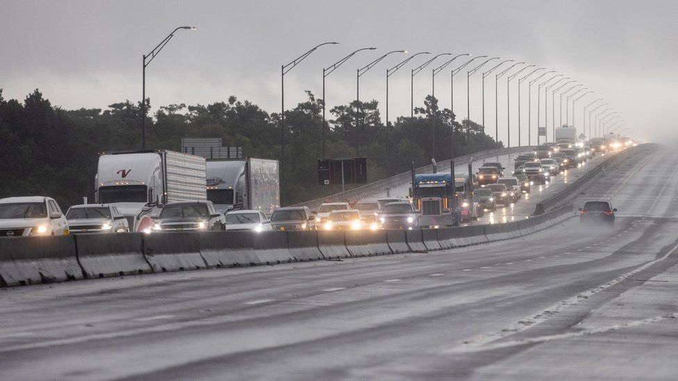
Traffic jams clogged some motorways out of Louisiana as residents in many areas were ordered to evacuate.
Governor John Bel Edwards warned the storm could be one of the biggest to hit the state in 150 years.
"Your window of time is closing," he warned residents on Saturday.
"By the time you go to bed tonight you need to be where you intend to ride the storm out and you need to be as prepared as you can be, because weather will start to deteriorate very quickly tomorrow."
The governor of neighbouring Mississippi has declared a state of emergency.
President Joe Biden said Ida was "turning into a very, very dangerous storm" and the federal government was ready to provide help.
The hurricane is intensifying over the warm waters of the Gulf of Mexico, boosting it from a category-2 to an extremely dangerous category-4 storm.

Tropical force winds are expected to sweep across southern Louisiana from 08:00 local time (13:00 GMT).
Coincidentally, Sunday marks the 16th anniversary of Hurricane Katrina, which devastated New Orleans after making landfall as a category 3. Katrina flooded 80% of the city and killed more than 1,800 people.
"I am absolutely devastated thinking about those communities under mandatory evacuation orders," Alessandra Jerolleman, a senior fellow in emergency management at New Orleans' Tulane University, told the BBC as she fled in her car.
"They can expect to see catastrophic and substantial damage... streets can be expected to flood, vehicles can be expected to be lost."
More than 80 oil rigs in the Gulf of Mexico have been evacuated and half the region's oil and gas output has been suspended.
Ida earlier battered part of Cuba, bringing down trees and tearing off roofs, while Jamaica suffered heavy rains. No one was reported killed.
The impact of climate change on the frequency of storms is still unclear, but increased sea surface temperatures warm the air above and make more energy available to drive hurricanes, cyclones and typhoons. As a result, they are likely to be more intense with more extreme rainfall.
Experts say that if storm surges hit at a time that coincides with high tides, sea water could flood over the New Orleans levee system and into the city.
https://news.google.com/__i/rss/rd/articles/CBMiMWh0dHBzOi8vd3d3LmJiYy5jb20vbmV3cy93b3JsZC11cy1jYW5hZGEtNTgzNzI3NDbSATVodHRwczovL3d3dy5iYmMuY29tL25ld3Mvd29ybGQtdXMtY2FuYWRhLTU4MzcyNzQ2LmFtcA?oc=5
2021-08-28 23:01:22Z
52781835510720
Tidak ada komentar:
Posting Komentar